
Situation
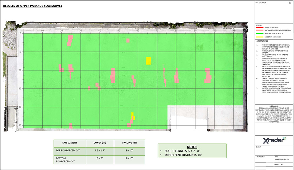
With evidence of cracking and rust, our client was concerned about corrosion and the danger of a failing concrete slab within their parkade. In order to identify the extent of the damage and determine repairs, Xradar were enlisted to map the area for corrosion.
Concrete corrosion is created when water and oxygen are able to get through concrete pores or voids, starting a chemical reaction of corrosion and degradation of the steel within the structure. It often goes undetected until it is too late. By mapping and identifying corrosion you can thoroughly assess your structure and prevent costly damages.
Solution
Involving an engineer, Xradar scanned the parkade slab and walls using Ground Penetrating Radar (GPR) and Xradar Enhanced Concrete Scanning to identify areas of corrosion.
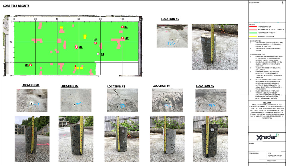
Through computer assisted image analysis a map was produced detailing the areas of concern and core samples were taken to verify the results. A 3D Laser Scan of the parkade was also carried out, with information presented and overlaid on the images in the report.
Following the scan the results were used to estimate the quantities for repair and to observe potential future corrosion hot spots.
If you are concerned about concrete corrosion, get in touch today.